|
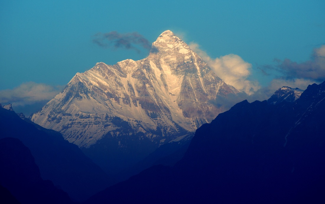
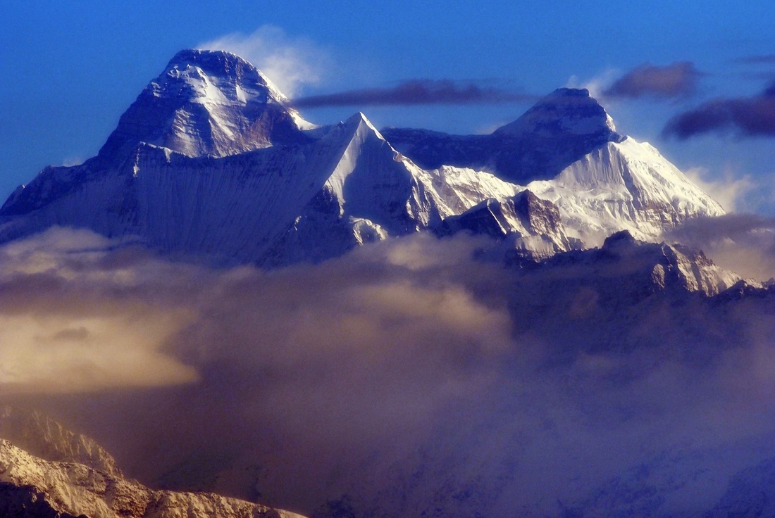
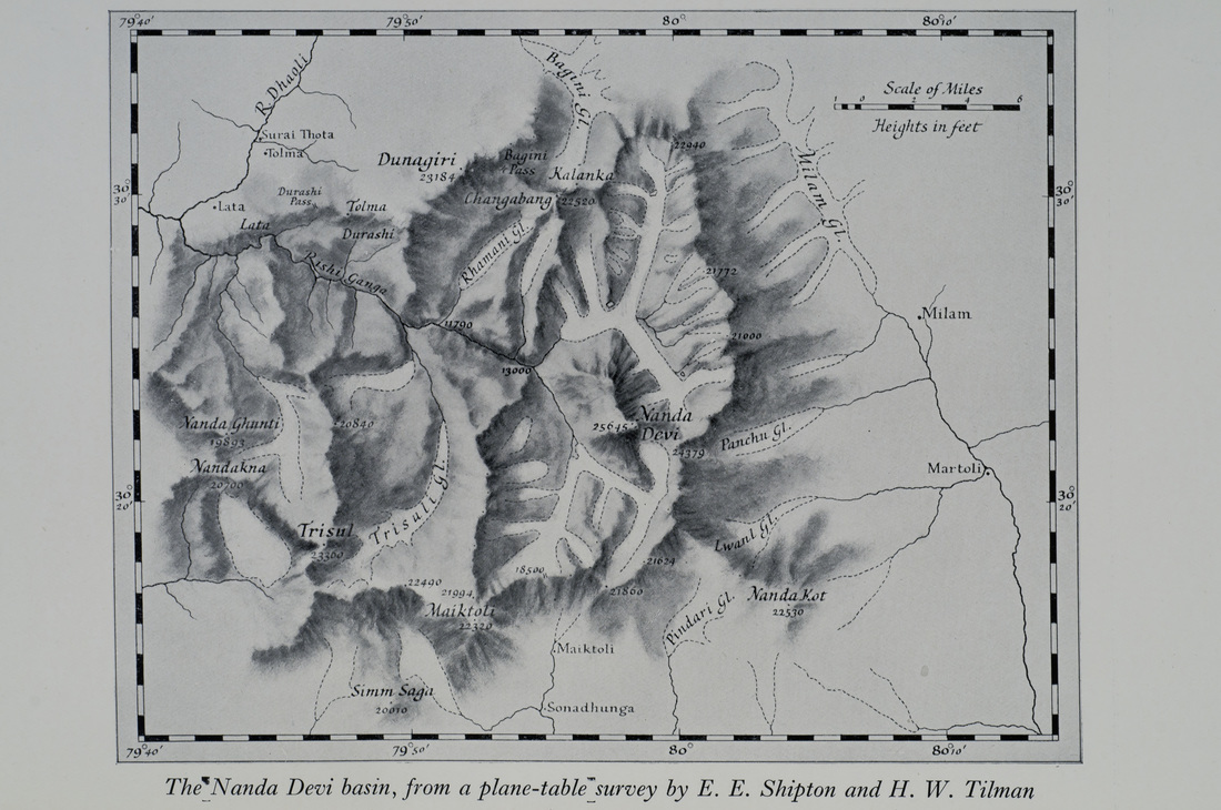
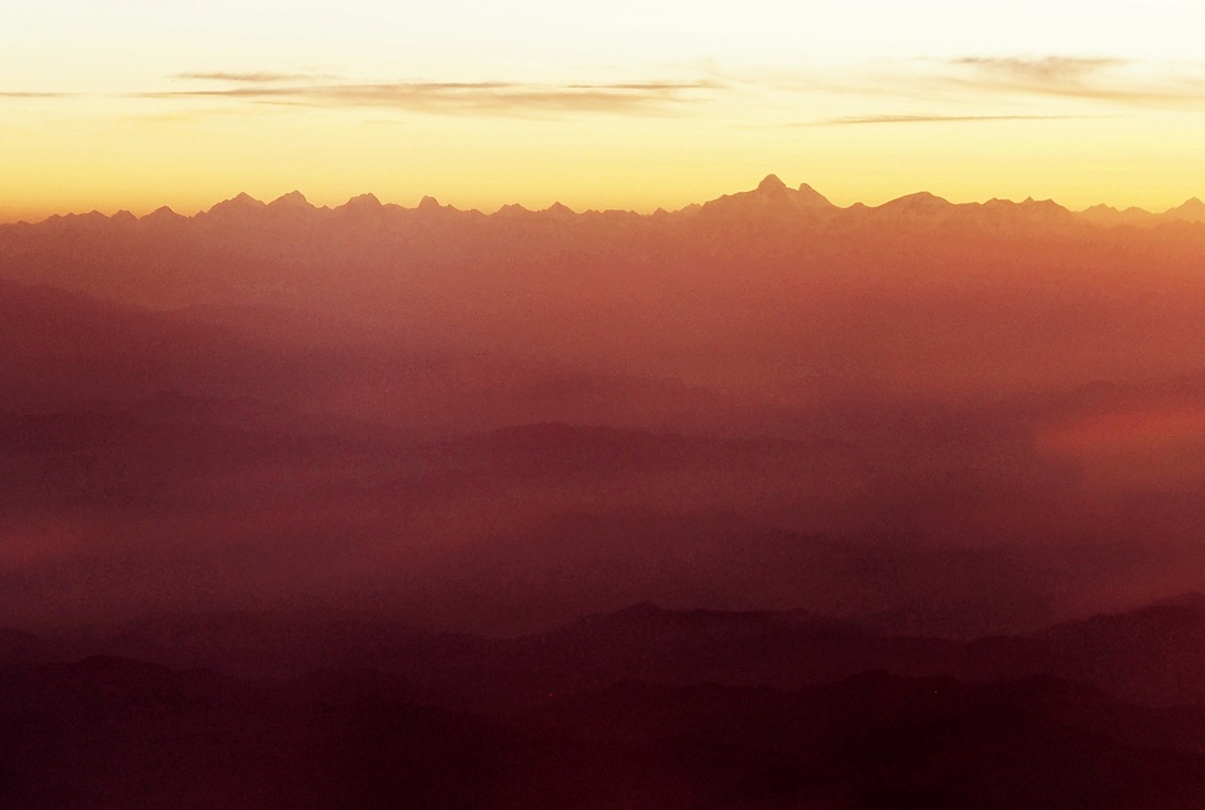
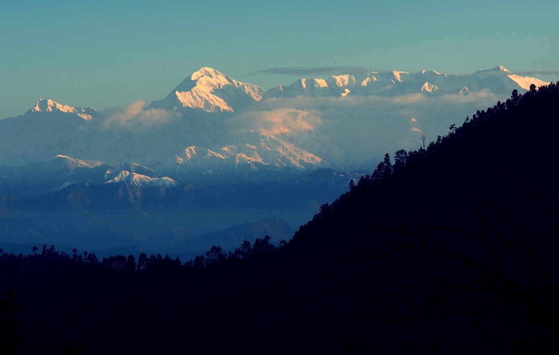
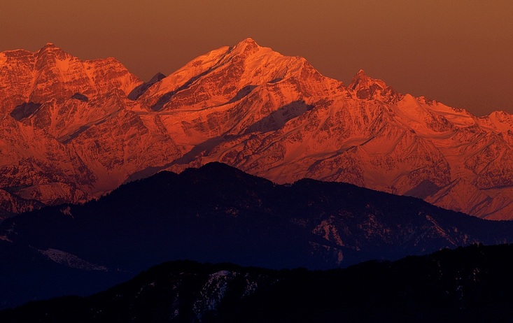
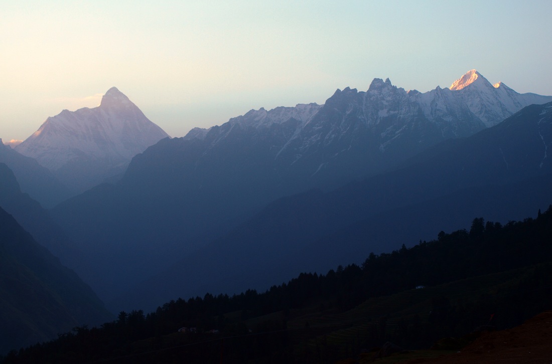
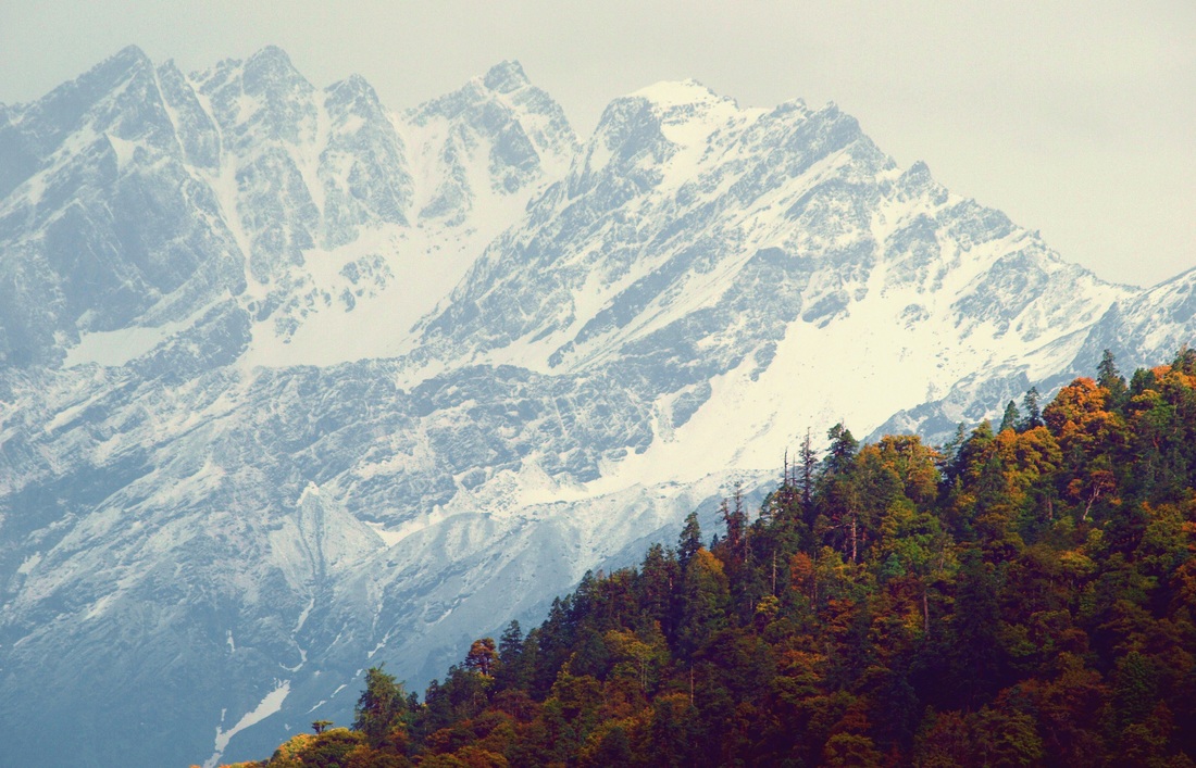
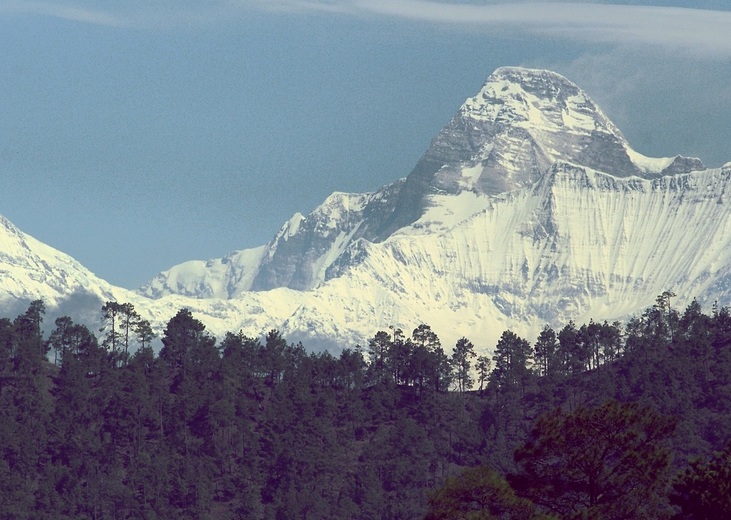
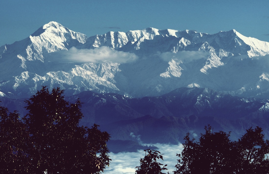
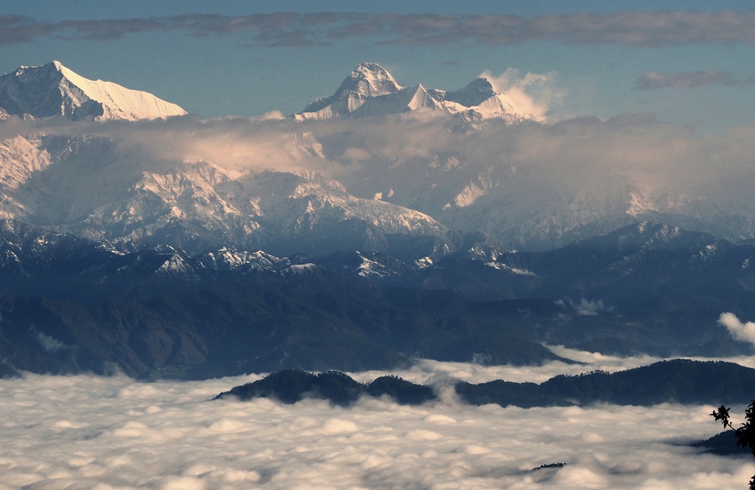
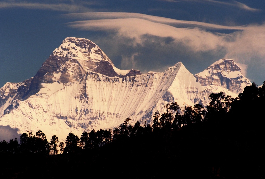
I was drawn to Binsar for many years for one purpose only….. to view the spectacular side-on twin-peaked profile of Mt. Nanda Devi in all her glory. Nowhere in the world is a peak this unique in shape, or this formidable to approach! The shape, contours and fantastic topography make this one of the last great adventures in mountaineering and trekking. The mountain was first climbed by H.W.Tilman and Noel Odell in 1936 after earlier attempts by T.G.Longstaff (in 1926, 1927) and Hugh Ruttledge in 1932 failed. It was for long considered a tougher adventure than reaching the South Pole such was the difficulty of the terrain and access! The sanctuary is impregnable. And when I say “Impregnable”, I mean a world so inaccessible that there is only one extremely narrow harrowing path that leads into the 630.3 square kilometer sanctuary, with a sheer and slippery rock face on one side and a thousand foot drop into a treacherous Rishi Ganga gorge on the other, at the bottom of which is an icy, raging river, yes, the dreaded Rishi Ganga river, whose waters are so cold that if the rocks don’t crush you first, hypothermia will certainly kill you in minutes! Just in case the gorge and the river are not enough, the sanctuary is surrounded by, not one, but two parallel layers of mountain ranges on the north, south and east side, each of which are at an average height of 21,000 ft. The outer wall of the sanctuary comprise of some of the highest peaks in the middle Himalayas such as Trishul (23,360 ft), Nanda Ghunti (19,893 ft), Nanda Kot (22,530 ft), Mriguthani, Maiktoli (22,320 ft) and several others. Each of these peaks are insurmountable for the expert trekker, so in the event that an explorer-mountaineer is actually able to cross the first ring of peaks, he or she will be confronted by another layer of equally high peaks! The second inner range of mountains comprise of Changabang (22,520 ft.), Dunagiri (23,184 ft.), Kalanka (22,520 ft.), Bethartoli, Hardeol and several others, each over 21,000 ft high. To the north of the sanctuary are the high plains and valleys of Tibet and to the west, the sheer ridges of the Badrinath peaks rise beyond Joshimath. The Nanda Devi group itself, around which the interest of Tillman and myself gyrated throughout our voyage to Calcutta, presents unusual features. Imagine a main ridge running from north to south and in the southern half three arms projecting to the west. At the southern extremity a long one leads up to Trisul, 23,360 feet, and terminates ten miles to the west in Nandakna, 20,700 feet. Several miles north is a shorter arm on which is Dunagiri, 23,184 feet, and between the two lies the shortest arm of all which ends abruptly at Nanda Devi itself. From Trisul and from Dunagiri two spurs project towards each other to form the fourth side of the wall, nowhere less than 18,000 feet high, which surrounds Nanda Devi. The only breach in this formidable barrier is between these spurs where the Rishi Ganga, the river which drains the glaciers around Nanda Devi, breaks through by way of a deep gorge. – from the book, Nanda Devi, by Eric Shipton I have photographed Mt. Nanda Devi from Auli in the Garhwal Himalayas, from 32,000 ft while flying south from Leh, in Ladakh, to Delhi, from Chakrata in the Western Himalayas and, most recently, during my vacation, from Binsar in Kumaon. Her majestic shape with her famous twin peaks is like no other mountain, as is her location in the middle of the Himalayan Range. She stands taller than the peaks surrounding her by a good 3000 ft and is so massive that for many years, and before Mt. Everest was “discovered”, the world considered her to be the highest peak on the planet. Mt. Nanda Devi is, of course, the 23rd highest mountain in the world as we know today, but she is India’s highest peak wholly inside the country’s borders. Mt. Kanchenjunga is India’s highest peak and the world’s third highest mountain but straddles that Indo-Nepal border. Working west to east the first view of Nanda Devi can be had from a small garrison town on the westernmost border of the state of Uttarakhand on the border with Himachal Pradesh. Chakrata is a small town remote in its location in the western Garhwal Himalayas at an altitude of 7000 ft. One gets there relatively easily driving west from Dehra Dun towards Paonta Sahib on the banks of the Yamuna River. A turn right (north) takes us to Herbertpur in the foothills and then onto Chakrata (or Chakrota has the locals call it). The town itself has no special significance to the average tourist who takes day trips there to view the magnificent Yamunotri peaks. But just south of Chakrata is a fortified military camp where India’s ultra secretive Special Frontier Force, or Establishment 22 (pronounced Two-Two) trained ethnic Tibetans of the Indian Army on mountain warfare and also, as locals declared, serves as a remote prison for those prisoners that threaten national security, sort of like an “Indian Guantanamo”. I went there on a film assignment on a very cold January in 2012, excited at the opportunity of photographing a remote part of the Indian Himalayas. I was initially made to understand that Nanda Devi could be viewed clearly from the upper reaches of the town but that was not to be. The Yamunotri peaks, source of the River Yamuna, are very close and block all views further east due to their sheer height. My friend and I awoke early in the morning to see whether we could see the Goddess in the morning light and we trekked to a high point above our hotel. Since the sun rose behind the Himalayan peaks from our vantage point the mountains were silhouetted against the sun. But we were in luck! Her sheer size meant that she rose strongly above the surrounding peaks even though we were well over 300 Kms away!! The winter morning in January was cold but the brilliance of the sunrise through the pine forest made up any discomfort we felt. The Nanda Devi Sanctuary or the Nanda Devi Biosphere Reserve as it is known locally has its westernmost point just north of Joshimath (and 100 kms east of Chakrata as the crow flies) close to the ski resort of Auli. The resort is a few Kilometers outside the sanctuary but a trek up Auli bugyal (meadow) gives us a good panoramic view of the topography within the sanctuary. Deep within the narrow gorge lies the Rishi Ganga River that drains from within the sanctuary. For many years in the early 20th century explorers attempted to breach the outer walls of the sanctuary by making expedition attempts from the eastern walls via the Pindari and Milam glaciers but these failed. From this eastern end one had to climb 18,000 ft ridges just to gain access to the outer sanctuary, leave alone climb the 27,643 ft (7,816 m) high peak! Eric Shipton and H.W.Tilman finally found the only way in by trekking up the extremely hazardous Lata Kharak, the narrow “path” (its actually no more that a couple of feet wide and a steep rock-hewn climb) and following the Rishi Ganga. They had very capable support from Sherpas Angtharkey, Pasang and Kusang, avid and very capable mountaineers in their own right. The Sanctuary and National Park, established in 1982, has been mostly closed to trekkers and expeditions after it was declared a UNESCO World Network of Biosphere Reserves. Several problems of excessive garbage left by trekkers from past expeditions were reported by forest officials in the 1980s and 1990s and the Government became increasingly concerned about environmental damage to the fragile ecosystem. But no damage was worse than the 1965 joint mission by the Indian Intelligence and CIA to place a nuclear-powered remote sensing device (code named “Guru Rimpoche”) on the high reaches of Nanda Devi, at 24,000 ft, to clandestinely observe Chinese activities in Tibet, soon after the 1962 Indo-China war. As the expedition team reached Camp IV a severe blizzard forced them to secure the device on the mountain and abandon the climb. When the team returned to the mountain in 1966, the entire device including the plutonium powered generator had disappeared, possibly deep inside a crevice in the mountain as a result of melting snow and ice and avalanches over 12 months. It has not been found till date and the Indian Government, citing local beliefs about the Mother Goddess, put climbing the mountain off-limits. Fear of nuclear radiation contamination is the real reason. As the Team Leader of the expedition, Manmohan Singh Kohli of the 8th Indo-Tibetan Border Police, put it “Considering that over 200 people were involved and it went on for three years, this was the 20th century’s greatest mountaineering-cum-espionage operation. It stretched the limits of human endurance.” Over a dozen expeditions were made from 1965-68 to retrieve the device but failed. The drive from Delhi to Nainital in the Kumaon Himalayan foothills is a fairly easy one and after an overnight break one drives to the Indian hill town of Almora. This is where one gets the first glimpse of Mt. Trishul and Mt. Nanda Ghunti on the southern boundary “wall” of the Nanda Devi Sanctuary. The high ridges around Almora prevents us from any views further east till we enter the Binsar Wildlife Sanctuary just off the highway to Bageshwar. The Binsar Sanctuary is located at about 7000 ft on top of a ridge and gives us a 180 degree of the Western Himalayan peaks with Mt. Chaukhamba farthest west, followed by Mt. Nanda Ghunti, then Mt. Trishul, Mt. Mriguthani and finally the Queen and Mother Goddess of the Indian Himalayas, Mt. Nanda Devi. She stands tall and supreme high above the clouds, almost all of her covered in snow as her high base of 13,000 ft is well above the treeline. East of Nanda Devi is Mt. Maiktoli and Nanda Kot and then the peaks drop off till the India-Nepal border. While there are several treks in this area, most famous of which is the Roopkund trek at the base of Mt. Trishul, none of these treks enable the avid explorer to enter the Inner Sanctuary of the Biosphere Reserve. The closest approach is had via the Milam Glacier trek where one is able to climb close to the source of the glacier, up the high walls of the Outer Sanctuary but climbers and expeditions have not found it worth their while to make so arduous a climb to merely reach the Inner walls of the Sanctuary, leave alone climb up the Inner wall, which, by itself, is another 18,000 ft climb. Shipton and Tillman came the opposite route, through the Rishi Ganga valley and Lata Kharak, into the Inner Sanctuary and then climbed the walls of the Inner Sanctuary to view the Milam and Pindari glaciers from the other end, but they too did not find it worth their while to descend the Outer wall. The entire route west to east or the other way round, further aided by the closure of the Sanctuary, remains unexplored. The North and north-west wall of the Sanctuary is bound by three impregnable peaks, Mt Kalanka, Mt Changabang (considered one of the most beautiful of Himalayan peaks) and Mt. Dunagiri. Beyond the slopes of these peaks lies the vast high altitude desert of Tibet. The area here remains unexplored due to the tough border restrictions and the Indo-China border conflict, although this area is undisputed. The beauty of this area is superbly described by Eric Shipton in his book as he stood on top of a high ridge on Nanda Devi, “I can never hope to see a finer mountain view: the Badrinath peaks, Kamet, the Kosa group, Dunagiri, and the great peaks of the northern part of the Nanda Devi basin- all mountains amongst which we have been traveling for the past four months, served merely as a foil to set off the stupendous ranges lying beyond Milam and across the borders or western Nepal. What a field of exploration lay there-the heritage of some future generation.” – from the book, Nanda Devi, by Eric Shipton The Nanda Devi Sanctuary remains one of the last places on earth uncontaminated by human settlement and is home to the most elusive of predators, the snow leopard. The wide meadows inside the Sanctuary are grazed by the Himalayan musk deer, Himalayan tahr and other carnivores like the black bear and brown bear. Most of these creatures have not seen humans in their lifetime since the park was closed, even to shepherds. All of the Sanctuary lies above the tree line well above 10,000 ft and is beautiful study of the earth’s ancient ecosystem of life here before the encroachment of humans. This World Heritage Site is unchanged from the time that Eric Shipton first set foot in its meadows and ridges and the Government of India continues to make every effort to ensure it remains this way. I really hope it does for our own sake.
Comments are closed.
|
AuthorI'm a travel junkie, photographer and a newbie blogger. More coming soon! TRAVEL DEALSArchives
May 2018
|

 RSS Feed
