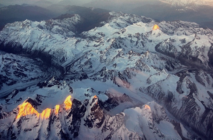
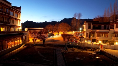
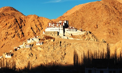
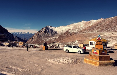
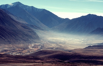
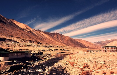
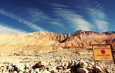
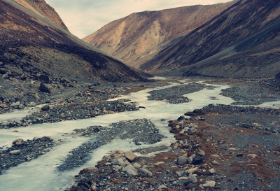
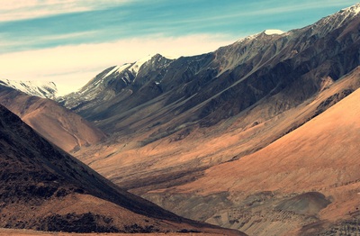
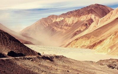
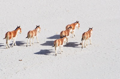
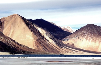
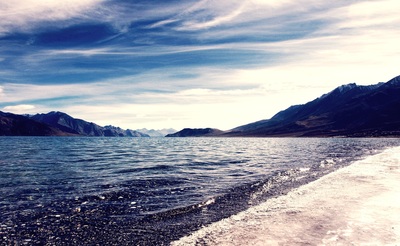
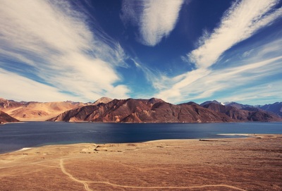
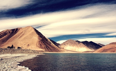
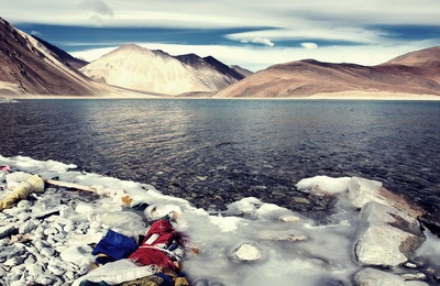
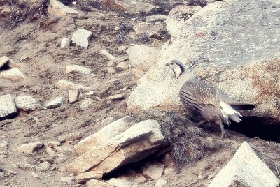
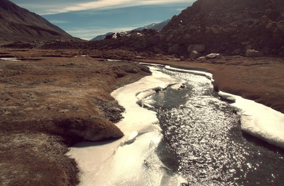
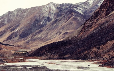
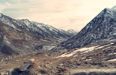
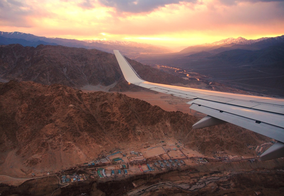
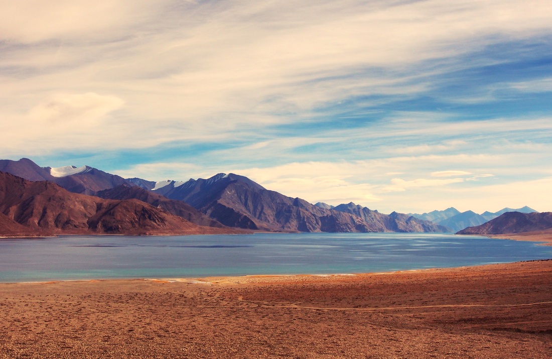
 Dawn on the Zanskar Peaks Dawn on the Zanskar Peaks I covered two of the three large high altitude saltwater lakes during my previous visit to Ladakh in 2011. Tso Kar and Tso Moriri were gorgeous in different ways but the biggest and most famous of them, Pangong Tso, eluded me. I also wanted to experience a bit of the harsh sub-arctic Ladakh winter where temperatures can drop down to -40 C or even lower. With these two objectives in mind my wife, Aparna, and I decided to take a short trip to "The Land of High Passes", as the name "Ladakh" means. The airfares in December were really low and both return tickets (via Jet Airways, outbound, and Go Air, return) came to no more than INR 11,000, a real steal and half the normal fare! The selection of our hotel was not as simple as we thought as 90% of the hotels were shut in winter. We also read that most eating outlets remain closed as the patrons shut down their shutters and leave for warmer climes like Delhi and parts of Himachal Pradesh. I was also aware how cold it can really get without central heating, having spent a few years in the US midwest, so heating became a priority. The 2-3 budget hotels that were open had no central heating so we narrowed down on the Grand Dragon Hotel (Image 1), Leh's only "five star" hotel. Aparna negotiated a great rate that was half their summer rates as the hotel was running on empty for the week we were planning to go. No flight to Ladakh is complete without the customary views of the Himalayas on either side of the window. However, while the "glamor" views of Mt. Nanda Devi, Kamet and Trishul can be had from the starboard (right) side of the aircraft, the sunrise does not allow for a clear view if photography is your objective. I chose our seats on the port (left) side of the Boeing 737-700 aircraft and was not disappointed. Twenty minutes after the flight took off I saw the foothills of the Himalayas. This view was soon replaced by the sudden rise of the middle Himalayas, the Dhaulagiris, of Himachal Pradesh, as we flew over Paonta Sahib on our right (the place where the river Yamuna hits the plains), and flew directly over Shimla and passed Manali on our left. The peaks grew higher as we crossed Rohtang Pass and crossed into the Zanskar area of West Ladakh. We saw the most amazing craggy peaks and glaciers as the winter snow was beginning to accumulate in the 20,000 ft massifs. The steep landing into Leh is one of the trip's highlights as the aircraft loses altitude sharply to dip from 32,000 ft to the 12,000 ft height of Leh valley, crossing the 21,000 ft Stok Range. It takes a trained pilot to land here, compounded by the added complexity of rarified air at this altitude where the aircraft does not get the necessary drag and lift of the plains. Sweet!! Much of Day 1 was spent lying in bed after a wonderful breakfast at the Grand Dragon and we caught up on sleep. The view from our hotel room was awesome (posted in the "Landscape" page) and the cup of chai had by the side of the window was sublime! We decided to head out for a late lunch and was told to eat at a reputed Kashmiri restaurant, Wazwan, in Leh market. The food there was very good as we were hungry and they had a separate seating area with central heating. After lunch we went to Shanti Stupa but could not stay long there as Aparna was troubled by the freezing cold (about -6 C) and the windchill. I had been there on my previous trip so wasn't overtly concerned about photo opportunities. We headed back to our hotel and went to sleep early. The rarefied air did not trouble us too much and we slept soundly. Day 2 was for the standard city tour, the perfect way to acclimatise. I was initially thinking of driving to Pangong Tso on the second day itself to give myself a buffer day in case the weather set in suddenly, but was dissuaded by the hotel staff, rightfully so. We were not yet fully acclimatised and that became apparent when Aparna started getting a headache as we returned from the Indus-Zanskar Confluence point. Some meds were needed and she also took a diamox as a preventive in case things got really worse. I was fine as I have good experience of traveling at high altitudes, but breathing was getting a bit difficult. We spent the evening planning for our 5 hour each way drive to Pangong and asked the hotel to prepare us a boxed lunch. We also used the hotel's own Toyota Innova as they came with oxygen cylinders and a first aid kit, not to mention a highly trained and experienced driver. Spending three days in Ladakh just did not give us the time to take unnecessary risks. Ladakh is built of a series of high ridges with an average altitude of 20,000 ft. The valleys between these ridges lie at altitudes ranging between 10,000 ft ( e.g. at Nubra) to 14,000 ft (at Pangong and Moriri), so to travel between valleys one has to cross high-altitude passes that could range anywhere between 13,000 ft to over 18,000 ft, hence the name "Land of High Passes". The ridges for the south-east portion of the Karakoram Mountain Range, often mistakenly described as a part of the Himalayas, but are actually a different mountain range linked to the Himalayas and have a very unique topography of their own. The northern boundary of the Karakorams are home to the highest concentration of 8000 m peaks outside of the Nepal Himalayas. Just north of Ladakh's Siachen area lies K2, the world's second highest mountain, and next to her are the other 8000 m peaks, Gasherbrums I and II and Broad. The area also boasts of several 7000 m + peaks like Masherbrum and are an impregnable northern boundary to the Indian Subcontinent. The Karakoram ridges in Ladakh are cut by three main rivers from east to west, respectively, the Shyok, Indus and Zanskar. The drive to Pangong in the winter is a day's drive, each way of 5 hours, and is done by crossing the Chang La ("La" meaning "pass"). The drive south-east, on Day 3, took us past the monasteries of Shey, Thiksey and Chemrey (Image 2) and, from the latter, the road begins to climb. I was a bit tense as the impact of altitude change on us, and mostly Aparna, was unknown. I have been traveling to the Himalayas over the last 25 years to various altitudes, so I usually acclimatise well. Aparna can be prone to some nausea and headaches so she popped diamox before we headed out. The winter morning was clear and the skies were a deep blue so I was optimistic that the we would go through Chang La without any problem. No snow was predicted in the area but mountain predictions can be notoriously unreliable. That said, the air was dry so I did not expect any precipitation. Snow at these altitudes, similar to that at Everst Base Camp, can be devastating, especially in the winter. As the road climbed higher beyond the village of Sakti, we left all civilization behind and all we saw were barren wind-swept high ridges. There was no vegetation as most of Ladakh is in the rain shadow region of the Himalayas and well above the tree line. The landscape here is the same as what one experiences in Tibet as the land mass is one and the same. Tibetans commonly refer Ladakh as "Western Tibet". Being winter there was no tourist traffic on the road. None! We passed the first car carrying local goods after more than an hour, that too in the opposite direction! It took us three hours to reach Chang La (Image 3), well on time. Our driver, Chhiring, insisted that we spend no more than five minutes as the pass was at 17,688 ft (5,360 meters), roughly the same altitude as Everest Base Camp (EBC), and higher than K2's base camp. High Altitude Sickness (HAS) can set in quickly at this height if we are not careful, for fit and unfit people alike, so all we did was take a few usual pics and a quick bio break at the open shed of a toilet (yeah, frozen poop and pee everywhere...awesome!!). The wind was bone-chilling and I regretted not wearing an extra layer under my jeans. The temperature here must have been around -15 C but the wind-chill would have been closer to -25 C. The army folks based here did not even bother to get out of their warm shelters as they looked incredulously at us. They must have been wondering why anybody would even try to venture into the mountains in the winter, that too in Ladakh! From Chang La it was all downhill. We passed the small army camp at Tsoltak and then headed in a south-easterly direction towards Durbuk valley (Image 4). The army has a major military presence at Durbuk and Tangtse (image 5) as these are the last permanent human settlements till the Chinese border at Pangong Tso. Tangtse is the official gateway to the Changthang and we had to check in at the office of the Wildlife Department (Image 6). We also had our breakfast here consisting of chicken sandwiches and coffee. The altitude here was a comfortable 12,000 ft so we did not face any breathing difficulties. The Shyok River, originating at the Rimo Glacier near the Siachen Glacier and located just one massive ridge away, flows south-east and, just north of Tangtse, takes a complete U-turn and flows north-west into Nubra. This strange route can be attributed to the impact area between Tibet and the Subcontinent with the Karakorams forcing the south-east route. A break on the ridges north of Tangtse gives the river a chance to flow towards the Indus watershed. The Harong stream at Tangtse (Image 5), originates at a glacier in the Pangong range and flows north-west parallel to the Shyok, finally merging with the river. Beyond Tangtse, the valley narrows further as the road climbs higher towards Pangong and it gets colder. We begin to see substantial icing on the fast flowing Harong with the drop in temperature till we reach parts where the entire stream is frozen (image 7). The valley then opens up a bit alongside high snow-clad ridges of the Pangong range (image 8). The scenes are dramatic and we continue to climb till we reach an area covered by a field of sand, somewhat like a micro-Nubra. The sudden change is stark and a big contrast to the moraine-like topography we saw earlier. From the corner of my eye I see some shapes in the sand. Kiang (image 10)!! These Tibetan wild asses are extremely shy creatures and are found in plenty near the Morey Plains of Tso Kar further south but I had not expected to see them near Pangong. They were sitting calmly in the sand and, on hearing the engine of our car, started moving away nervously. I took a few pics and we then drove downhill towards Pangong. We reached the beautiful blue saltwater lake (images 11-15) at 12:30 PM after a five and half hour drive. The sky was blue, with strands of high clouds. As we turned south along the banks of the lake I saw beautiful lenticular cloud formation along the high peaks. A third of the lake, about 34 Kms, lies within India and the rest of the 100 Kms is in China/Tibet. The distant peaks in China can be seen as one looks south east towards the border (image 12). The first week of December saw unusually warm weather in Ladakh so we could see the edges of the lake beginning to freeze (images 12 and 15) but not much else. But the ice was thick where it had frozen and we were told that the entire 134 Km length of the lake (a mere 5 KM at its widest point) freezes by January, and gets thick enough for vehicles to drive over. There was a visitors area next to the Army canteen and we decided to have our lunch of chicken sandwiches, fruit and juice, washed down further by coffee. The coffee was not strong but it was hot and thats what mattered. A couple of soldiers of the Rajput Regiment based there came over to say "Hi"; brave souls defending the nation in an inhospitable land. Aparna went to say hello to their officer who was friendly but did not want to say too much due to the sensitivity of the border area. He said that the Chinese troops kept to their side of the border in this area and any "incursions" were discussed regularly over flag meetings and through Delhi. We were the only tourists there that day. After taking a few more shots we decided to head back as we had to reach Leh before sunset.
3 Comments
|
AuthorI'm a travel junkie, photographer and a newbie blogger. More coming soon! TRAVEL DEALSArchives
May 2018
|
 RSS Feed
